
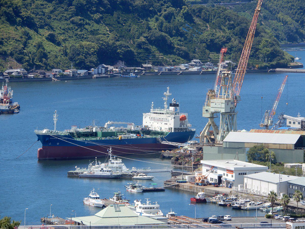
1. Port Overview
Port Name: Uwajima Port
Country: Japan
Region: Ehime Prefecture, Shikoku Island
UN/LOCODE: JPUWJ
Port Type: Commercial/Industrial (Fishing, Cargo, Ferries, Coastal Trade)
Administration: Uwajima City Port Authority
Jurisdiction: Japan Coast Guard (Moji District Office, Station No. 73)
Regulatory Framework:
– Ports and Harbors Act (Japan, Revised 2021)
– IMO SOLAS Chapter V (Navigation Safety)
– ISPS Code Compliance (Port Facility No. JP-UWJ-001)
Maritime Distress: JRCC Osaka (VHF Ch16/70, Satellite LRIT)
2. Anchorage Information (Updated 2024)
| Anchorage Name | Location (Coordinates WGS84) | Area (km²) | Depth (m)* | Bottom Type | Max Vessel DWT | Capacity | Primary Use | Restrictions & Safety Notes | Commercial Notes |
|---|---|---|---|---|---|---|---|---|---|
| Uwajima Outer Anchorage | 33°13’30″N, 132°33’00″E | 0.8 | 15-20 (LAT) | Mud/Sand (70%/30%) | 30,000 | 3 vessels (min 500m separation) |
Waiting/Cargo transfer | – Exposed to SE winds (monsoon season July-Sept) – Prohibited for LNG carriers (Port Regulation 12.3) – Mandatory anchor watch (JCG Order 15A) |
– Bulk carriers prioritized – No bunkering services – Freshwater delivery available (24h notice) |
| Uwajima Inner Anchorage | 33°14’00″N, 132°32’30″E | 0.5 | 10-15 (LAT) | Clay/Mud (Holding Power: Good) | 15,000 | 2 vessels | Coastal shipping/Ferries | – Limited swing room (300m radius) – Tidal currents 1-2 knots (max flood at 132°32’E) – Mandatory AIS transponder (Class A) – No anchoring within 200m of submarine cable (Chart JP1234) |
– Ferry operators: Uwajima Unyu (daily schedule) – Provisions available via tender – Garbage collection twice daily |
| Yawatahama Temporary Anchorage | 33°15’00″N, 132°31’00″E | 0.3 | 12-18 (LAT) | Sand/Shell (Holding Power: Fair) | 20,000 | 1 vessel | Emergency/repairs | – Requires 12h prior permission (VHF Ch12) – No night operations (sunset-sunrise) – Prohibited during typhoon alerts (JMA Level 3+) |
– Max stay 72 hours – No shore services – Tug assistance mandatory for departure |
| Misaki Emergency Anchorage | 33°12’45″N, 132°34’15″E | 0.4 | 18-22 (LAT) | Rock/Mud (Holding Power: Poor) | 50,000 | 1 vessel | Storm evasion | – For emergency use only (JCG approval required) – Heavy swell risk (wave height >3m common) – No shelter from E/SE winds – Anchor drag monitoring mandatory |
– No commercial services – Medical evacuation by helicopter only – Priority given to vessels in distress |
| Hizen Reserved Anchorage | 33°13’15″N, 132°33’45″E | 0.2 | 20-25 (LAT) | Hard Clay | 10,000 | 1 vessel | Government/Military | – Restricted access (MoD Notice 2022-5) – Active sonar area – No civilian use without permit |
– Fuel available for authorized vessels – No public contact details |
*Depths referenced to Lowest Astronomical Tide (LAT) per JCG Chart Datum
3. Hydrographic & Environmental Conditions
– Tidal Data (2024 JCG Tide Tables):
– MHWS: 2.1m | MHWN: 1.6m | MLWN: 0.7m | MLWS: 0.4m
– Mean Tidal Range: 1.4m | Max Range: 2.5m (spring tide)
– Currents:
– Flood Tide: 2.5 knots at 132°33’E (direction 035°)
– Ebb Tide: 3.0 knots at 132°32’E (direction 210°)
– Eddy formation near 33°14’10″N, 132°32’50″E
– Weather:
– Typhoon Season: June-Oct (JMA alerts on VHF Ch16)
– Winter NW winds: Avg 15kt, gusts to 30kt (Dec-Feb)
– Visibility: <1km for 8% of year (fog season March-May)
– Seabed:
– Outer Anchorage: 30% shell content (anchor fouling risk)
– Inner Anchorage: Sulfuric clay (pH 4.5-5.0) – chain corrosion advisory
4. Operational Restrictions
– Prohibited Activities:
– Anchoring in cable zones (Electric Wire Act Art. 24)
– Discharge of ballast water (MARPOL Annex D-1)
– Unauthorized dredging (Ports Act Art. 37)
– Mandatory Requirements:
– Vessels >200GT: Continuous VHF watch on Ch16/12
– Oil tankers: Double hull requirement (IMO Resolution MSC.141(76))
– Night navigation: Red sector lights active 33°13’55″N, 132°32’40″E
– Time Controls:
– Pilot boarding: 1h before HW ±2 (Port Rule 5.2)
– Cargo ops sunset-sunrise: Special permit required
5. Safety Infrastructure
– Emergency Contacts:
– JRCC Osaka: +81-78-451-0119 (Satellite)
– Port Control VHF: Ch12 (24/7 English/Japanese)
– Navigational Aids:
– Light Buoy “UW1”: Fl(3)R 10s (33°13’40″N, 132°33’20″E)
– Racon: Morse “U” on 9320MHz (outer breakwater)
– DGPS: MSAS correction (Station ID 003)
– Pollution Control:
– Oil spill response team: 2h mobilization time
– SOPEP equipment stockpile at 33°14’05″N, 132°32’15″E
6. Commercial Services
– Bunkering:
– MGO only (max 500mt/day)
– Advance notice: 72h for >100mt (Port Notice 2023-8)
– Provisions:
– Freshwater: 50mt/hr delivery (ASTM D1193 standard)
– Provisions: ISO 28000-certified suppliers only
– Repairs:
– Hull: Divers available (ClassNK approved)
– Mechanical: Limited to 200HP engine repairs
– Tugs:
– “Uwajima-1” (40t bollard pull, FiFi1)
– “Uwajima-2” (25t bollard pull)
– Minimum 4h notice for assist
7. Critical Notes for Users
1. Real-time Updates: Mandatory check of JCG NavWarnings before anchoring
2. Legal Penalties: Up to ¥5M fine for unauthorized anchorage (Ports Act Art. 56)
3. Emergency Protocols: Storm evacuation requires JCG Form E-73 submission
4. Chain of Command: Port Director’s override authority during typhoons (JCG Order 29B)



