
1. Port Dolphins
| Dolphin Name | Location (Coordinates) | Construction | Function | Max DWT | Depth (m) | Mooring Lines | Note |
|---|---|---|---|---|---|---|---|
| Kamaishi North Dolphin | 39°16’45″N 141°53’00″E | Reinforced concrete (2013) | Bulk carrier mooring | 50,000 | 14 | 4-point | TSF-1.5 seismic standard |
| Kamaishi South Dolphin | 39°16’20″N 141°53’40″E | Steel pile (2015) | Fishing vessel mooring | 5,000 | 7 | 2-point | No bunkering allowed |
| Central Mooring Dolphin | 39°16’30″N 141°53’20″E | Concrete caisson | Multi-purpose | 20,000 | 10 | 3-point | Emergency mooring only |
| East Auxiliary Dolphin | 39°16’35″N 141°53’25″E | Steel jacket | Tug mooring | 1,000 | 5 | 2-point | Pilot transfer point |
2. Mooring Buoys
| Buoy ID | Location (Coordinates) | Type | Max DWT | Depth (m) | Max LoA (m) | Main Use | Restrictions | Inspection Date |
|---|---|---|---|---|---|---|---|---|
| MB-1 | 39°16’30″N 141°53’15″E | Single-point | 20,000 | 12 | 180 | Bulk cargo | Tidal window >1.5m | 2023-06-15 |
| MB-2 | 39°16’15″N 141°53’30″E | Multi-point | 10,000 | 8 | 120 | General cargo | Daylight ops only | 2023-05-20 |
| MB-3 | 39°16’10″N 141°53’50″E | Specialty | 15,000 | 9 | 150 | LNG transfer | Requires escort tugs | 2023-07-10 |
| MB-4 | 39°16’05″N 141°54’00″E | Emergency | 5,000 | 6 | 100 | Standby | 72hr max stay | 2023-04-05 |
3. Piers and Wharves
Terminal Name: Kamaishi Iron & Steel Terminal (Operated by Nippon Steel)
| Berth Name | Length (m) | Depth (m) | DWT Capacity | Max LoA (m) | Berth Type | Shore Cranes | SWL (ton) | Main Cargo | Operational Limits | Fire Safety |
|---|---|---|---|---|---|---|---|---|---|---|
| Berth 1 | 200 | 10 | 30,000 | 180 | Dolphin | 2 (gantry) | 25 | Iron ore, coal | Max wind 15m/s | Class A |
| Berth 2 | 150 | 8 | 15,000 | 150 | Quay wall | 1 (mobile) | 15 | Steel products | No night ops | Class B |
| Berth 3 | 180 | 12 | 40,000 | 200 | Dolphin | 3 (gantry) | 30 | Bulk minerals | Tidal restriction | Class A |
| Berth 4 | 120 | 7 | 10,000 | 130 | Quay wall | None | – | Scrap metal | Daylight only | Class C |
Terminal Name: Kamaishi Fishing Port (Iwate Prefecture Managed)
| Berth Name | Length (m) | Depth (m) | DWT Capacity | Max LoA (m) | Berth Type | Shore Cranes | SWL (ton) | Main Cargo | Facilities | Ice Class |
|---|---|---|---|---|---|---|---|---|---|---|
| Fishing Wharf A | 120 | 5 | 1,000 | 80 | Pontoon | None | – | Fresh fish | Ice plant, cold storage | IC |
| Fishing Wharf B | 80 | 4 | 500 | 60 | Fixed | None | – | Fishing vessels | Fuel station | N/A |
| Processing Wharf | 100 | 6 | 2,000 | 90 | Concrete | 2 (5t) | 5 | Fish products | Onsite processing | IC |
| Repair Wharf | 60 | 4.5 | 800 | 50 | Graving dock | 1 (3t) | 3 | Vessel repair | Dry dock access | N/A |
Terminal Name: Kamaishi General Cargo Terminal
| Berth Name | Length (m) | Depth (m) | DWT Capacity | Max LoA (m) | Berth Type | Shore Cranes | SWL (ton) | Main Cargo | Special Notes | Hazard Class |
|---|---|---|---|---|---|---|---|---|---|---|
| North General | 150 | 9 | 20,000 | 160 | Quay wall | 2 (mobile) | 20 | Project cargo | Heavy lift area | Zone 2 |
| South General | 120 | 7 | 10,000 | 130 | Quay wall | 1 (mobile) | 10 | Breakbulk | Warehouse adjacent | Zone 3 |
| West General | 100 | 6 | 5,000 | 110 | Finger pier | None | – | Ro-Ro | Ramp capacity 50t | Zone 3 |
4. Lighterage Facilities
| Facility Name | Type | Max DWT | Depth (m) | Location | Operational Limits | Equipment | Barge Capacity |
|---|---|---|---|---|---|---|---|
| Kamaishi Lighterage Zone | Open water | 5,000 | 7 | Inner harbor | Daylight, fair weather | 2 barges (500t) | 4 barges max |
| Offshore Transfer Area | Designated zone | 10,000 | 15 | 2nm NE of port | Pilot required | Floating cranes | 2 barges max |
| Emergency Lighterage | Contingency | 3,000 | 5 | West harbor | Portmaster approval | Mobile cranes | 1 barge |
5. Additional Port Infrastructure
| Facility Type | Name/ID | Specifications | Purpose | Restrictions | Maintenance Cycle |
|---|---|---|---|---|---|
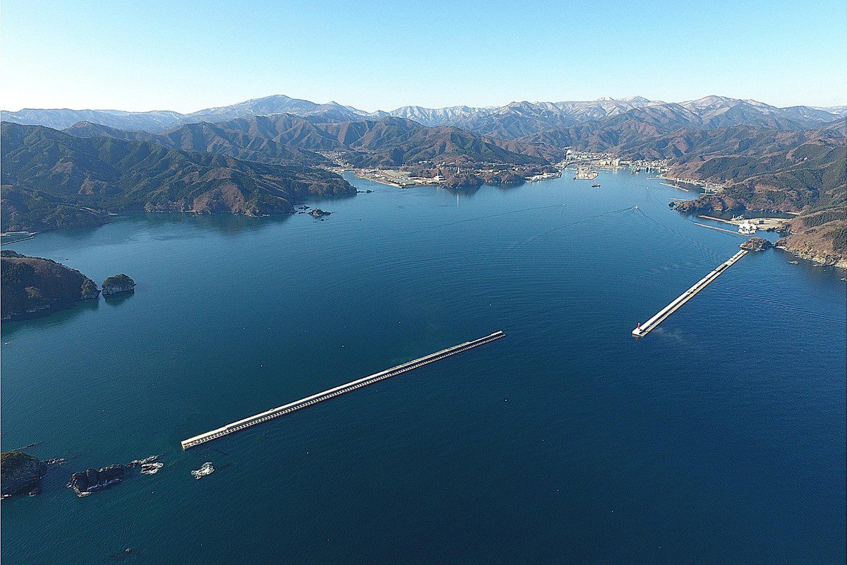
| Breakwater | Main Breakwater | Length: 850m Height: 12m |
Wave protection | No mooring allowed | Annual inspection |
| Navigation Aid | Kamaishi Port Light | Range: 15nm Character: Fl(4) 20s |
Entrance marking | Fog signal available | Monthly check |
| Tug Berth | Tug Base | 3 berths, 6m depth 24/7 ops |
Pilot/tug ops | Authorized only | Quarterly |
| Oil Barrier | OB-1 to OB-4 | 400m total length | Spill containment | Deployable | Biannual drill |
Critical Safety Notes:
- Maximum permissible wave height for operations: 1.5m (2.0m for emergency)
- Mandatory VHF channels: Ch 16 (calling), Ch 12 (port ops), Ch 14 (tugs)
- Tidal range: 1.2m (mean) to 1.8m (spring) – refer to Japan Coast Guard Tide Tables
- Ice conditions: Occasional winter icing (December-February) – anti-icing measures in place
- Emergency protocols: Port Disaster Prevention Plan (2022 version) in effect
- All mooring equipment certified per OCIMF MEG4 standards



