Mokpo
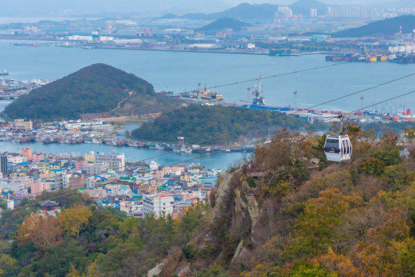
Located in the Southwestern end of the country, Mokpo has become the forth port in Korea since its opening in Oct. 1st. 1897. the other three were the port of Pusan, the port of Wonsan and the port of Inchon.
| Classification | Item | Scale | Capacity |
|---|---|---|---|
| Berthing-Facilities | Quay-Handling Place-Floating pier | 2,691M 3,147M 10 |
30,000~50,000tons-14 ships Under 100tons-90 ship |
SAMHAK WHARFS
Samhak wharfs comprised 4 berths, can berth 4 ships as large as of 30,000 tons to 5,000 tons simultaneously are dealing with grains, coal, and general cargoes.
| Berth | Length(m) | Berthing Capacity | Annual Handling Capacity | Remark | |
|---|---|---|---|---|---|
| Tonnage | No. of ships | ||||
| 1 | 168 | 5,000 | 1 | 241,000 tons | |
| 2 | 250 | 30,000 | 1 | 650,000 tons | LLC 1 |
| 3 | 240 | 30,000 | 1 | 227,000 tons | |
| 4 | 135 | 5,000 | 1 | 266,000 tons | |
DAEBUL WHARFS
Cargoes produced in Daebul industrial complex are treated. There are 3 piers of 20,000 tonclass and annual handling capacity is 1,890,000 tons.
| Berth | Length(m) | Berthing Capacity | Annual Handling Capacity | Remark | |
|---|---|---|---|---|---|
| Tonnage | No. of ships | ||||
| 1 | 210 | 20,000 | 1 | 630,000 tons | |
| 2 | 210 | 20,000 | 1 | 630,000 tons | |
| 3 | 210 | 20,000 | 1 | 630,000 tons | |
PASSENGER WHARFS
In mokpo Passenger Wharfs, 23 passenger ships run through 17 routes 84 times per day, Mokpo to Jeju and Hongdo, and 60 passenger ships operated through 42 routes in a competent district of Mokpo are 43% of Korea’s total passenger-ships The international passenger terminal will play important role in international passenger ships service to the port Shanghai in China and Japan, etc.
EXCLUSIVE WHARFS
The Mokpo harbor featurs exclusive wharfs for as well as a private unloading stations of cement, oil and iron.
| Pier | Length(m) | Berthing Capacity | Annual Handling Capacity | Constructor | |
|---|---|---|---|---|---|
| Tonnage | No. of ships | ||||
| Ssanyong | 165 | 10,000 | 1 | 756,000 tons | Ssangyong |
| Dongyang | 190 | 10,000 | 1 | 635,000 tons | Dongyang |
| Oil dolphin | 310 | 6,000 | 2 | 1,500,000 tons | 4 oil finery co |
| Samho | 372 | 10,000 | 1 | 756,000 tons | Samho heavy IND |
| 20,000 | 1 | 315,000 tons | |||
Wando Port
Facilities
| Classification | Item | Scale | Capacity |
|---|---|---|---|
| Berthing Facilities | Quay | 210m | 1 ship of less than 20,000ton |
| Handling place | 11 ships of less than 500ton | ||
| Floating pier | 20m x 10m 2EA | 2 ships of less than 200ton | |
| 30m x 14m 1EA | 2 ships of less than 100ton | ||
| 30m x 15m 1EA | 1 ship of less than 3,200ton | ||
| 30m x 15m 1EA | 1 ship of less than 6,300ton |
Berth
| Berth | Length(m) | Depth | Capacity | |
|---|---|---|---|---|
| No. 1 handling place | 1,235m | 3.5m | ||
| No. 2 handling place | 661m | 2m | ||
| No. 3 handling place | 90m | 4m | ||
| 275m | 9 – 10m | |||
| 190m | 9 – 10m | |||
| No. 3 | 210m | 9 – 10m | ||
Miscellaneous
| Waterspace in harbor : 4.7 Skm | Depth of water : 2m – 10m |
|---|---|
| Average of tidal range : 1.3m | the drift of a current : 0.15m/sec |
Berths in Mokpo
- Points of embarkation and disembarkation of pilots
- First pilot point (Gasa Island) : N34-27-42, E126-03-45
- Second pilot point (Bulmugi Island) : N34-46-00, E126-15-00
- Quarantine Anchorages and Berts
Quarantine Anchorages and Berts Harbor Name Location Berthing Capacity (G/T) Ship Inside Boundary of Mokpo Port 1 Sea within 250m radius of N34°46’30”, E126°23’12” 30,000 Berth waiting 2 Sea within 250m radius of N34°46’34”, E126°23’32” 30,000 〃 3 Sea within 250m radius of N34°46’40”, E126°23’50” 30,000 〃 4 Sea within 250m radius of N34°46’42”, E126°24’10” 10,000 〃 6 Sea within 250m radius of N34°47’10”, E126°25’36” 10,000 〃 7 Sea within 300m radius of N34°44’32”, E126°20’13” 30,000 Berth waiting and passing ships 8 Sea within 300m radius of N34°44’23”, E126°20’40” 30,000 Berth waiting 9 Sea within 300m radius of N34°44’07”, E126°21’10” 5,000 〃 Quarantine Anchorage Sea within 500m radius of N34°45’38”, E126°20’29” 50,000 Quarantine anchorage Outside Boundary of Mokpo Port 10 Sea within 1km radius of N34°47’06”, E126°16’21” 20,000 Hazard material carrying ships 11 Sea within 1km radius of N34°47’06”, E126°15’00” 50,000 Berth waiting 12 Sea within 1km radius of N34°44’30”, E126°13’00” 100,000 〃 13 Sea within 1km radius of N34°43’21”, E126°13’00” 100,000 〃 14 (Gasa Island) Sea within 2km radius of N34°26’41”, E125°57’32” 200,000 Temporary touching by passing ships


