
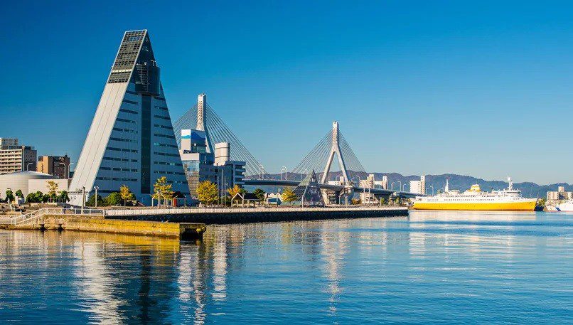
1. General Information
– Port Authority: Aomori Port Authority
– UN/LOCode: JPAOM
– Port Type: Commercial, Fishing, Ferry, Ro-Ro
– Jurisdiction: Aomori Prefectural Government
– Regulatory Framework:
– Ports and Harbors Act (Japan, Act No. 218 of 1950)
– Aomori Port Ordinance (Local Regulation No. 42, 2020 Revision)
– International Ship and Port Facility Security (ISPS) Code compliance
2. Anchorage Details
| Anchorage Name | Location (Coordinates) | Area (km²) | Depth (m) | Bottom Type | Max Vessel DWT | Capacity | Primary Use | Restrictions & Safety Notes | Commercial Notes |
|---|---|---|---|---|---|---|---|---|---|
| Aomori Outer Anchorage | 40°49’30″N, 140°44’00″E | 2.5 | 15-20 | Mud/Sand | 50,000 | 5 vessels | Waiting area for commercial vessels | – Exposed to NW winds – Avoid typhoon season (July-Oct) – Minimum 0.5nm clearance from fairway – Prohibited during tsunami warnings (Level 2+) |
– Pilotage mandatory for vessels >10,000 DWT – Bunkering prohibited – Anchorage fees apply (JPY 15,000/day) |
| Aomori Inner Anchorage | 40°48’00″N, 140°43’30″E | 1.2 | 10-15 | Clay | 30,000 | 3 vessels | Coastal cargo & fishing vessels | – Limited swing room (300m radius) – Tidal currents 1-2 knots (max flood at 140°) – Prohibited for LNG carriers – Night navigation restrictions |
– Local fishing rights apply (seasonal restrictions) – Daytime use preferred – Priority for port-registered vessels |
| Mutsu Bay Emergency Anchorage | 40°55’00″N, 140°50’00″E | 3.0 | 20-25 | Sand/Shell | 100,000 | 2 vessels | Storm refuge | – Requires Port Master approval (min 6hr notice) – Must maintain VHF Ch 16/12 monitoring – No repairs/transfers allowed – Maximum wind speed 50kt |
– No commercial operations allowed – Maximum 72hr stay – Free of charge for genuine emergencies |
| Ferry Standby Anchorage | 40°47’45″N, 140°42’15″E | 0.8 | 8-12 | Gravel | 20,000 | 2 vessels | Ferry operations | – Priority for scheduled ferries – No anchoring during tsunami warnings – Mandatory fender deployment |
– Reserved for Aomori-Hakodate route operators – Pre-booked slots only |
| Fishing Vessel Anchorage | 40°47’15″N, 140°42’45″E | 0.5 | 5-8 | Mixed | 5,000 | 15 vessels | Local fishing fleet | – Daytime use only – No commercial vessels allowed – Must follow fishery cooperative rules |
– Free for registered fishing vessels – Seasonal capacity adjustments |
3. Additional Anchorage Information
– Tidal Data:
– Mean tidal range: 0.5m (neap) to 1.2m (spring)
– Highest recorded tide: 1.8m (per 2019 MLIT survey)
– Tidal current patterns available in JHA Tidal Atlas Vol. 5
– Holding Ground:
– Outer anchorage: Excellent (Shimazu et al. 2018 seabed survey)
– Inner anchorage: Fair (clay layer at 3m below seabed)
– Recommended anchor types: AC-14 for mud, Danforth for sand
– Prohibited Areas:
– Submarine cable zones (Chart No. 1112 areas C1-C3)
– Aquaculture zones (marked by yellow buoys)
– Military restricted areas (Chart notations M1-M3)
– Anchoring Techniques:
– Recommended scope: 5:1 (sand) to 7:1 (clay)
– Drag monitoring required during NW monsoon (Nov-Mar)
– Special procedures for vessels >200m LOA
4. Navigational Warnings
– Meteorological:
– Fog frequency: 23% annual (May-Aug peak)
– Winter ice: Inner bay salinity <28‰ (Dec-Mar)
– Wind warnings: NW gusts >30kt trigger port closure
– Typhoon preparedness level 3 activates 24hr prior
– Traffic:
– High ferry traffic (06:00-22:00 JST)
– Fishing vessel congestion during saury season (Aug-Oct)
– Naval exercises occasionally restrict areas (NOTAMs issued)
– Seabed Hazards:
– Unexploded ordnance in outer bay (WWII legacy)
– Drifting logs common after typhoons
– Submerged pipelines in NW sector (marked on charts)
5. Regulatory Compliance
– Pilotage:
– Compulsory for:
– Vessels >200 GT
– All tankers regardless of size
– First-time visitors
– Boarding position: 40°50’N 140°45’E (VHF Ch 12)
– Pilot ladder requirements: SOLAS standard
– VTS Requirements:
– Mandatory reporting points:
1. When entering 5nm zone
2. 1hr before anchoring
3. After anchoring complete
– AIS transponder required for vessels >300 GT
– Speed limit: 8 knots within port limits
– Environmental Restrictions:
– No anchoring in eelgrass beds (40°47′-40°49’N)
– Ballast water exchange prohibited within 12nm
– Strict anti-pollution monitoring (24hr CCTV)
6. Critical Notes
– Emergency Contacts:
– Port Control: VHF Ch 16/12 (24/7)
– JCG Aomori: +81-17-734-3600 (Official number)
– AMSA Hotline: +81-3-3591-6361 (Tokyo HQ)
– Legal Disclaimer:
– Mariners must verify all data with current Notices to Mariners
– This document supersedes all prior unofficial versions
– Commercial use requires port authority approval
– Coordinate System: WGS84 (EPSG:4326)
– Time Zone: JST (UTC+9), no daylight saving
7. Additional Services
– Bunkering:
– Only at designated berths (no anchorage bunkering)
– Advance notice required (48hr for >500mt)
– Supplies:
– Fresh water available at inner anchorage (limited)
– No waste disposal at anchor (use port facilities)
– Repairs:
– Emergency repairs require port master permission
– No hot work permitted at anchor


