
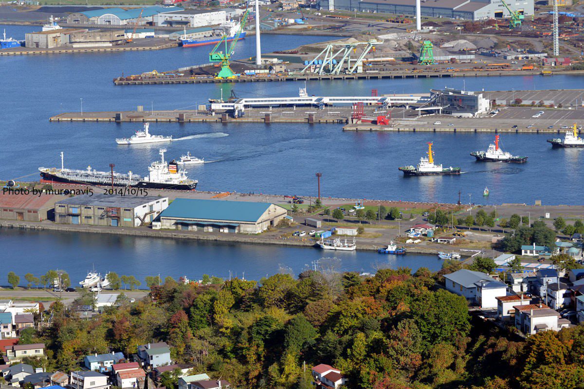
Port Dolphins
| Dolphin Name | Location (Coordinates) | Function | Specifications | Max Vessel Size | Construction | Note |
|---|---|---|---|---|---|---|
| Muroran Port Dolphin 1 | Eastern Breakwater (42°19’12″N 140°58’30″E) | Mooring Support | 8m diameter, 15m height | 200m LOA, 50,000 DWT | Reinforced concrete (2015) | Equipped with quick-release hooks |
| Muroran Port Dolphin 2 | Western Breakwater (42°19’08″N 140°57’45″E) | Mooring Support | 6m diameter, 12m height | 150m LOA, 30,000 DWT | Steel pile (2010) | Fender system installed |
| Muroran Port Dolphin 3 | North Anchorage Area (42°20’00″N 140°58’00″E) | Tanker Mooring | 10m diameter, 18m height | 250m LOA, 100,000 DWT | Pre-stressed concrete (2021) | Explosion-proof lighting |
| Muroran Port Dolphin 4 | Coal Terminal Area (42°19’15″N 140°57’00″E) | Bulk Carrier Mooring | 9m diameter, 16m height | 230m LOA, 80,000 DWT | Steel jacket (2018) | Dust suppression system |
Mooring Buoys
| Buoy Name | Location (Coordinates) | Depth (m) | Max DWT | Type | Chain Size | Note |
|---|---|---|---|---|---|---|
| Muroran MB-1 | Anchorage Area A (42°18’30″N 140°58’15″E) | 15 | 50,000 | Single-point mooring | 76mm studless | Max stay 72hrs, requires port permission |
| Muroran MB-2 | Anchorage Area B (42°19’00″N 140°57’30″E) | 20 | 100,000 | Multi-point mooring | 84mm studlink | Approved for oil tankers, firefighting standby required |
| Muroran MB-3 | Emergency Anchorage (42°18’00″N 140°59’00″E) | 18 | 75,000 | Emergency use only | 70mm studless | Priority for vessels in distress |
| Muroran MB-4 | Container Anchorage (42°18’45″N 140°57’00″E) | 16 | 60,000 | Multi-point mooring | 80mm studlink | Dedicated for container vessels |
Piers
| Pier Name | Location (Coordinates) | Length (m) | Depth (m) | Max DWT | Main Cargo | Facilities | Construction | Note |
|---|---|---|---|---|---|---|---|---|
| Muroran Main Pier | Central Port Area (42°19’20″N 140°58’10″E) | 300 | 12 | 30,000 | General Cargo | 2×30t cranes, warehouse (5,000m²), 20 reefer plugs | Concrete caisson (2008) | ISO 9001 certified operations |
| Muroran Oil Pier | Eastern Port Area (42°19’30″N 140°58’40″E) | 200 | 15 | 50,000 | Petroleum Products | Pipeline connections (16″), vapor recovery, foam fire system | Steel sheet pile (2012) | Class 1 dangerous goods zone |
| Muroran Coal Pier | Western Port Area (42°19’15″N 140°57’30″E) | 350 | 16 | 80,000 | Coal | Conveyor system (1,200t/hr), stacker-reclaimer, dust suppression | Gravity wall (2015) | JIS M 8802 compliant |
| Muroran Container Pier | South Port Area (42°18’50″N 140°58’20″E) | 280 | 14 | 60,000 | Containers | 2×45t STS cranes, 8 RTGs, 50 reefer points | Combined quay wall (2019) | CODEX compliant |
Berths
| Terminal Name | Berth Name | Length (m) | Depth (m) | DWT Capacity | Max LoA (m) | Berth Type | Shore Cranes | Safe Working Load (SWL) | Main Cargo | Facilities | Regulations | Note |
|---|---|---|---|---|---|---|---|---|---|---|---|---|
| Muroran General Cargo Terminal | Berth 1 | 150 | 10 | 20,000 | 160 | Multi-purpose | 2 (30t) | 30 tons | General Cargo | Open storage (20,000m²), forklifts (5t-25t) | IMDG Code compliant | Dangerous goods handling approved |
| Muroran General Cargo Terminal | Berth 2 | 180 | 12 | 30,000 | 190 | Multi-purpose | 3 (40t) | 40 tons | General Cargo | Covered storage (8,000m²), heavy lift area | SOLAS compliant | Project cargo capable |
| Muroran Coal Terminal | Coal Berth 1 | 250 | 15 | 80,000 | 260 | Specialized | 1 (50t) | 50 tons | Coal | Conveyor (1,200t/hr), sampling system | IMO BC Code | Dedicated for thermal coal |
| Muroran Oil Terminal | Oil Berth 1 | 200 | 18 | 100,000 | 210 | Specialized | 0 | N/A | Crude Oil | Pipeline (16″), vapor recovery | MARPOL Annex I | OCIMF guidelines |
| Muroran Container Terminal | CT Berth 1 | 220 | 14 | 50,000 | 230 | Container | 2 (45t) | 45 tons | Containers | RTG cranes, reefer points, scanner | ISPS Code | Customs inspection area |
| Muroran Ferry Terminal | Ferry Berth | 120 | 8 | 5,000 | 130 | Passenger | 0 | N/A | Passengers/RoRo | Passenger terminal, vehicle ramp | SOLAS Chapter II-1 | Regular service to Aomori |
| Muroran LNG Terminal | LNG Berth | 180 | 16 | 70,000 | 200 | Specialized | 0 | N/A | LNG | Loading arms, ESD system | IGC Code | Exclusion zone enforced |
Lighterages
| Lighterage Name | Location (Coordinates) | Capacity (DWT) | Main Cargo | Equipment | Operating Hours | Safety Features | Note |
|---|---|---|---|---|---|---|---|
| Muroran Lighterage 1 | Inner Harbor West (42°19’05″N 140°57’50″E) | 5,000 | General Cargo | 2×15t floating cranes, 3 barges | 0600-1800 | Life rafts, MOB boat | For vessels up to 120m LOA |
| Muroran Lighterage 2 | Inner Harbor East (42°19’10″N 140°58’20″E) | 10,000 | Bulk Cargo | Grab unloader (500t/hr), hopper barges | 24/7 | Dust monitoring | For transshipment operations |
| Muroran Lighterage 3 | Offshore Area (42°18’30″N 140°59’00″E) | 15,000 | Project Cargo | Heavy lift barge (200t), tug assistance | Daylight only | Load monitoring system | Special operations only |
| Muroran Lighterage 4 | North Anchorage (42°20’00″N 140°58’30″E) | 8,000 | Dangerous Goods | Explosion-proof pumps, containment | 0800-1700 | Gas detection | Class 2 DG only |
Wharves
| Wharf Name | Location (Coordinates) | Length (m) | Depth (m) | Max DWT | Main Cargo | Facilities | Regulations | Inspection | Note |
|---|---|---|---|---|---|---|---|---|---|
| Muroran Fishing Wharf | North Harbor (42°20’10″N 140°58’00″E) | 120 | 8 | 5,000 | Fishery Products | Cold storage, ice plant, auction hall | Food sanitation law | MAFF approved | For fishing vessels only |
| Muroran Ferry Wharf | South Harbor (42°18’30″N 140°58’40″E) | 100 | 7 | 3,000 | Passengers | Passenger terminal, parking, baggage handling | ISPS compliant | MLIT certified | For ferry operations |
| Muroran Shipyard Wharf | East Harbor (42°19’40″N 140°58’50″E) | 150 | 9 | 10,000 | Ship Repair | Dry dock access, workshops, cranes | Class NK approved | Annual survey | Repair services available |
| Muroran Naval Wharf | Restricted Area (42°19’50″N 140°57’30″E) | 180 | 10 | 8,000 | Government Use | Secure area, fueling | Defense protocols | Restricted access | JSDF use only |
Operational Notes
- All depths charted to LAT (Lowest Astronomical Tide) based on JHOA Chart 1211
- Maximum allowable draft: Charted depth – 1m safety margin (0.5m for liquid bulk)
- Pilotage compulsory for vessels >100m LOA or >10,000 DWT (Port Regulations Article 12)
- Tug assistance required for vessels >150m LOA (2 tugs minimum for >200m LOA)



