
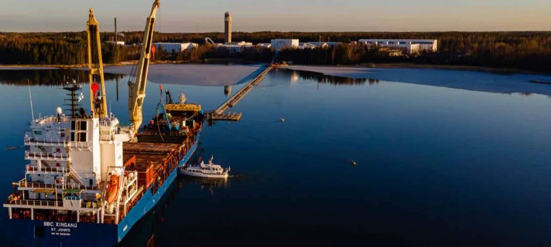
Port Dolphins at Sakai Port
| Dolphin Name | Location (WGS84) | Construction | Function | Fender Type | Load Capacity | Last Inspection | Note |
|---|---|---|---|---|---|---|---|
| North Breakwater Dolphin | 34°34’12″N 135°27’36″E | Reinforced concrete | Mooring assistance | D-cell 1000x2000mm | 200t lateral | 2024-01-15 | Built 2015, cathodic protection installed |
| South Channel Dolphin | 34°33’54″N 135°27’42″E | Steel pile cluster | Tanker mooring | Conical 1500mm | 150t breasting | 2024-02-20 | Equipped with quick-release hooks, fog light |
| East Approach Dolphin | 34°34’06″N 135°28’12″E | Concrete caisson | Navigation aid | Rubber block | 50t impact | 2023-11-30 | Radar reflector installed, RACON signal ‘M’ |
| West Anchorage Dolphin | 34°34’24″N 135°26’48″E | Steel jacket | Emergency mooring | Cellulose-fiber | 100t multi-directional | 2024-03-10 | Strobe light, AIS transmitter JP100234 |
Mooring Buoys at Sakai Port
| Buoy ID | Position | Type | Max Vessel Size | SWL (tonnes) | Chain Scope | Main Purpose | Light Characteristic | Last Inspection |
|---|---|---|---|---|---|---|---|---|
| MB-1 | 34°34’18″N 135°27’24″E | Single-point mooring | 50,000 DWT | 150 | 3:1 at 25m depth | Liquid bulk transfer | Fl Y 5s | 2024-03-15 |
| MB-2 | 34°33’48″N 135°27’30″E | Multi-point mooring | 30,000 DWT | 100 | 4-leg spread | General cargo standby | Q R | 2024-02-28 |
| MB-3 | 34°34’30″N 135°27’00″E | Emergency mooring | 20,000 DWT | 75 | 5:1 at 18m | Storm contingency | Fl(3)G 10s | 2023-11-20 |
| MB-4 | 34°33’36″N 135°28’12″E | Yoke mooring | 15,000 DWT | 60 | 2:1 at 12m | Bunkering | Fl R 4s | 2024-04-05 |
Piers and Wharves at Sakai Port
| Terminal Name | Berth Name | Length (m) | Depth (m) | DWT Capacity | Max LoA (m) | Max Beam (m) | Berth Type | Shore Cranes | SWL (tonnes) | Main Cargo | Operational Restrictions | Firefighting | Note |
|---|---|---|---|---|---|---|---|---|---|---|---|---|---|
| Sakai Central Terminal | CT-1 | 200 | 10.5 | 30,000 | 180 | 32 | General cargo | 2 x 25t | 25 | Steel products, machinery | No night ops (22:00-06:00) | Foam monitors x2 | Ro-Ro ramp available |
| CT-2 | 180 | 12.0 | 45,000 | 200 | 35 | Multi-purpose | 1 x 40t | 40 | Containers, project cargo | Hazardous cargo limited | Dry chemical x4 | Reefer connections x20 | |
| CT-3 | 150 | 9.0 | 15,000 | 150 | 28 | Coastal trade | – | – | Domestic cargo | Daylight ops only | Water hydrants x3 | No gantry cranes | |
| CT-4 | 220 | 11.5 | 35,000 | 190 | 32 | Breakbulk | 3 x 15t | 15 | Timber, paper rolls | Max beam 32m | CO2 system | New in 2022 | |
| CT-5 | 170 | 10.0 | 25,000 | 160 | 30 | Ro-Ro | 1 x 30t | 30 | Wheeled equipment | Max ramp slope 8° | Foam trolleys x2 | Straddle carrier access | |
| Sakai Liquid Terminal | LT-1 | 250 | 14.0 | 80,000 | 230 | 42 | Tanker berth | – | – | Crude oil, chemicals | Class 1 DG only | Water curtain system | Vapor recovery, 16″ arms |
| LT-2 | 200 | 12.5 | 50,000 | 210 | 38 | Tanker berth | – | – | LPG, LNG | No simultaneous ops | Deluge system | Cryogenic arms x3, -162°C | |
| LT-3 | 180 | 10.0 | 25,000 | 170 | 32 | Bunker station | – | – | Fuel oil, MGO | No crude transfer | Foam station | 24hr ops, 8″ lines | |
| LT-4 | 160 | 9.5 | 15,000 | 150 | 28 | Chemical berth | – | – | Edible oils, solvents | No pyrophoric materials | Dike containment | Stainless steel piping | |
| Sakai Bulk Terminal | BT-1 | 300 | 15.0 | 100,000 | 280 | 45 | Dry bulk | 2 x grab cranes | 35 | Coal, iron ore | Dust suppression required | Dust monitors | Conveyor to storage, 2000t/hr |
| BT-2 | 240 | 13.5 | 60,000 | 250 | 38 | Agricultural bulk | 1 x 20t | 20 | Grain, fertilizer | Explosion-proof lighting | Spark arrestors | Covered storage 50,000m³ | |
| BT-3 | 200 | 12.0 | 40,000 | 220 | 35 | Mineral bulk | 1 x 25t | 25 | Cement, gypsum | No simultaneous loading | Silica monitors | Pneumatic system | |
| Sakai Ferry Terminal | FT-1 | 120 | 8.0 | 10,000 | 130 | 25 | Passenger/Ro-Ro | – | – | Vehicles, passengers | Max 500 passengers | Life rafts x6 | Links to Seto Inland Sea |
| Sakai Container Terminal | CY-1 | 350 | 16.0 | 120,000 | 320 | 48 | Container | 3 x STS cranes | 50 | ISO containers | Max stack height 5 | Foam cannons x4 | On-dock rail, 6 tracks |
| CY-2 | 280 | 14.5 | 80,000 | 300 | 42 | Feeder | 2 x STS cranes | 40 | Regional containers | No OOG cargo | Hydrant system | Reefer plugs x100 |
Lighterage Facilities
| Facility Name | Type | Location | Max Barge Size | Handling Capacity | Tidal Window | Main Use | Safety Equipment | Note |
|---|---|---|---|---|---|---|---|---|
| North Lighterage Area | Floating platform | 34°34’42″N 135°27’18″E | 1,500 DWT | 500t/day | ±2hr HW | Coastal distribution | Life rings x4, fire extinguishers x2 | Concrete deck |
| South Lighterage Point | Beach landing | 34°33’30″N 135°27’54″E | 800 DWT | 300t/day | +1hr HW | Construction materials | First aid station | Gravel surface |
| West Floating Dock | Pontoon system | 34°34’12″N 135°26’36″E | 2,000 DWT | 700t/day | All tides | Project cargo | Emergency lighting | 100m² work area |
| East Barge Terminal | Dolphin mooring | 34°34’24″N 135°28’30″E | 1,200 DWT | 400t/day | -1hr LW | Scrap metal | Magnetic separator | Electrically grounded |
Operational Notes
- All depths refer to Chart Datum (CD) with tidal range of 2.8m (MHWS) to 0.3m (MLWS)
- Daytime operations defined as sunrise+1hr to sunset-1hr (local JMA publications)
- Hazardous cargo operations require 24hr advance notice via JP-SWAN system
- Maximum permissible wind speed: 15m/s for container ops, 12m/s for bulk ops
- Real-time port information available via Sakai VTS on VHF Ch.12/16 (156.600 MHz)
- Port security level currently MARSEC Level 1 (as of 2024-06-20)



