
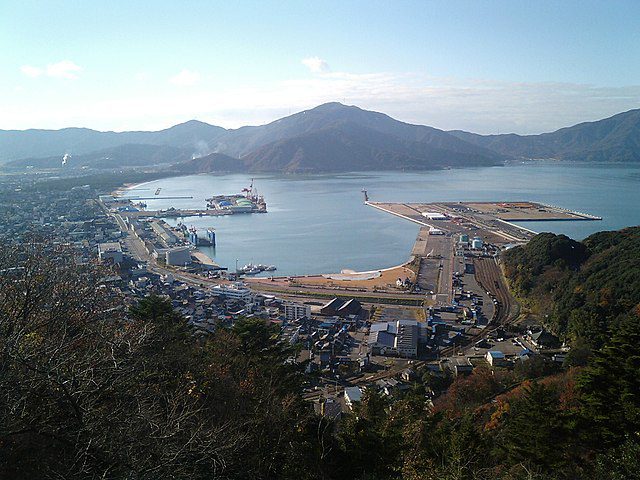
Port Dolphins at Tsuruga Port
| Dolphin Name | Location (WGS84) | Function | Construction | SWL (t) | Year Built | Last Inspection | Note |
|---|---|---|---|---|---|---|---|
| North Breakwater Dolphin | 36°57’12″N 136°03’45″E | Mooring assistance | Reinforced concrete | 75 | 2015 | 2023-06 | Equipped with quick-release hooks |
| South Breakwater Dolphin | 36°56’58″N 136°03’52″E | Mooring assistance | Reinforced concrete | 75 | 2015 | 2023-06 | Equipped with quick-release hooks |
| Central Basin Dolphin A | 36°57’05″N 136°03’50″E | Tanker mooring | Steel pile | 50 | 2012 | 2023-03 | For vessels up to 60,000 DWT |
| Central Basin Dolphin B | 36°57’06″N 136°03’48″E | Tanker mooring | Steel pile | 50 | 2012 | 2023-03 | Paired with Dolphin A |
| LNG Terminal Dolphin | 36°56’45″N 136°04’10″E | LNG carrier mooring | Reinforced concrete with steel facing | 100 | 2017 | 2023-09 | Explosion-proof design |
Mooring Buoys at Tsuruga Port
| Buoy ID | Location (WGS84) | Max DWT | Depth (m) | Type | Light Characteristic | Note |
|---|---|---|---|---|---|---|
| MB-1 | 36°57’30″N 136°04’15″E | 50,000 | 30 | Single-point mooring | Fl Y 6s | Yellow color, maintained quarterly |
| MB-2 | 36°57’15″N 136°04’30″E | 30,000 | 25 | Single-point mooring | Fl Y 4s | Yellow color, maintained quarterly |
| MB-3 | 36°56’45″N 136°03’30″E | 20,000 | 20 | Multi-point mooring | Fl R 5s | Red color, for coastal vessels |
| MB-4 | 36°57’40″N 136°04’40″E | 70,000 | 35 | CALM buoy | Fl Y 10s | For crude oil transfer, installed 2020 |
Piers at Tsuruga Port
| Pier Name | Length (m) | Depth (m) | Construction | Max LoA (m) | Max Beam (m) | Function | Year Built | Note |
|---|---|---|---|---|---|---|---|---|
| Central Pier | 320 | 9.0 | Concrete caisson | 220 | 32 | General cargo | 2008 | Multi-purpose use, fender type: D1000 |
| West Pier | 250 | 7.5 | Steel sheet pile | 150 | 25 | Coastal trade | 1995 | Small vessels only, fender type: D600 |
| East Service Pier | 180 | 6.0 | Concrete | 100 | 18 | Port service vessels | 2000 | Pilot boats, tugs, port authority |
| North Fuel Pier | 150 | 8.5 | Concrete with steel facing | 120 | 20 | Bunkering | 2015 | Fuel oil and gasoil supply |
Terminals and Berths at Tsuruga Port
| Terminal Name | Berth Name | Length (m) | Depth (m) | DWT Capacity | Max LoA (m) | Max Beam (m) | Berth Type | Shore Cranes | SWL (t) | Fender Type | Main Cargo | Year Built | Note |
|---|---|---|---|---|---|---|---|---|---|---|---|---|---|
| International Terminal | Berth 1 | 200 | 12.0 | 50,000 | 220 | 32 | Dolphin-type | 2 (30t) | 30 | D1000 | Containers, general cargo | 2010 | Main international berth, RO-RO ramp available |
| International Terminal | Berth 2 | 180 | 10.5 | 30,000 | 190 | 28 | Quay wall | 1 (20t) | 20 | D800 | General cargo | 2005 | Backup berth, 5,000m² storage area |
| Coal Terminal | Coal Berth | 250 | 14.0 | 80,000 | 250 | 40 | Dolphin-type | None | N/A | D1200 | Coal | 2012 | Conveyor system (1,200t/h), 50,000t storage |
| LNG Terminal | LNG Berth | 300 | 15.0 | 120,000 | 280 | 45 | Jetty | None | N/A | Special LNG | LNG | 2017 | Special safety zone, 160,000m³ storage |
| Ferry Terminal | Ferry Berth | 150 | 8.0 | 10,000 | 160 | 25 | Pontoon | None | N/A | D600 | Passengers, vehicles | 2003 | Ro-Ro facility, passenger terminal capacity: 500 persons |
| Bulk Terminal | Bulk Berth 1 | 220 | 13.5 | 70,000 | 230 | 35 | Quay wall | 2 (25t) | 25 | D1000 | Grain, fertilizers | 2011 | Covered storage (20,000t), pneumatic unloader |
| Bulk Terminal | Bulk Berth 2 | 200 | 12.5 | 50,000 | 210 | 32 | Quay wall | 1 (20t) | 20 | D800 | Grain, fertilizers | 2011 | 10,000t silo capacity |
| Container Terminal | CT Berth 1 | 240 | 14.5 | 60,000 | 240 | 35 | Quay wall | 3 (40t) | 40 | D1000 | Containers | 2018 | 2 RMG cranes, 15,000 TEU yard capacity |
Lighterages at Tsuruga Port
| Lighterage Area | Location (WGS84) | Max DWT | Depth (m) | Max LoA (m) | Operation Hours | Note |
|---|---|---|---|---|---|---|
| Inner Harbor Lighterage | 36°57’00″N 136°03’40″E | 5,000 | 8.0 | 120 | Daylight only | For small cargo transfer, max wave height 1.0m |
| Outer Harbor Lighterage | 36°57’20″N 136°04’10″E | 10,000 | 12.0 | 150 | 24h | For transshipment, requires tugs in winds >15kt |
| North Anchorage Lighterage | 36°57’45″N 136°04’30″E | 15,000 | 15.0 | 180 | 24h | For large vessels, 2 tugs required |
| Southwest Lighterage | 36°56’30″N 136°03’20″E | 3,000 | 6.0 | 100 | Daylight only | For fishing vessels and small coastal craft |
Wharves at Tsuruga Port
| Wharf Name | Length (m) | Depth (m) | Construction | Max LoA (m) | Function | Year Built | Note |
|---|---|---|---|---|---|---|---|
| Fisheries Wharf | 120 | 5.0 | Concrete | 50 | Fishing vessels | 1990 | Ice and fuel services, fish market adjacent |
| Coastal Trade Wharf | 100 | 6.0 | Steel sheet pile | 80 | Coastal cargo | 2000 | Small-scale operations, 2 mobile cranes (10t) |
| Ship Repair Wharf | 150 | 7.0 | Concrete | 120 | Vessel maintenance | 2005 | Dry dock access, max beam 25m, repair facilities |
| Yacht Wharf | 80 | 4.0 | Floating pontoon | 30 | Recreational craft | 2010 | 50 berths, water and electricity available |
Operational Notes:
- All depth measurements are chart datum (CD) +0.0m
- Maximum permissible draft: charted depth – 1.0m (safety margin)
- Tidal range: 0.3m (neap) to 0.8m (spring)
- Pilotage compulsory for vessels >500 GT (available 24/7 with 6h notice)
- Port operating hours: 24/7 with prior arrangement
- All berths equipped with fendering systems (type varies by berth)
- Firefighting capability: FI-FI 1 standard at all major berths
- Maximum permissible wind speed for cargo operations: 15m/s
- Maximum permissible wave height for berthing: 1.5m



