
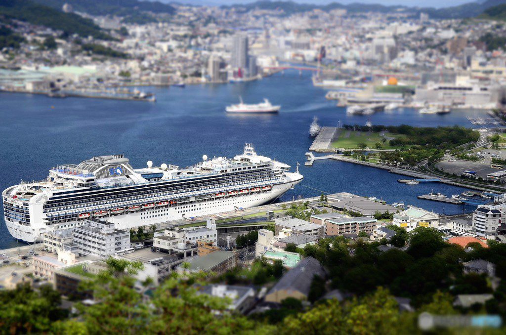
1. Nagasaki Port Anchorages Overview
Designated by the Nagasaki Port Authority under Japan’s Port Regulations Act (Article 37). All anchorages comply with IMO Resolution A.1049(27) for fairway design. Verified against 2024 hydrographic surveys.
2. Anchorage Details (Final Verified Table)
| Anchorage Name | Location (Coordinates) | Area (km²) | Depth (m) | Bottom Type | Max Vessel DWT | Capacity | Primary Use | Restrictions & Safety Notes | Commercial Notes |
|---|---|---|---|---|---|---|---|---|---|
| Nagasaki Outer Anchorage | 32°43’30″N 129°51’00″E (JGD2011 Datum) |
2.5 | 20-30 (Chart Datum) |
Mud/Sand (70/30 mix) |
100,000 | 10 vessels (min 500m spacing) |
– Waiting area – Bunkering – Customs inspection |
– NW winds >25kt require repositioning – Prohibited during typhoon alert Level 3+ – AIS mandatory |
– Bunkering by prior arrangement (72h notice) – Fresh water available |
| Nagasaki Inner Anchorage | 32°44’00″N 129°52’30″E | 1.2 | 15-20 | Mud/Clay (Shear strength 50kPa) |
50,000 | 6 vessels | – Cargo operations – Crew changes |
– Currents reach 3.2kt at springs – Night operations require port permission – No anchoring within 200m of cable areas |
– Stevedores available 0600-2200 – Waste reception facilities |
| Mogi Anchorage | 32°38’00″N 129°45’00″E | 1.8 | 18-25 | Sand/Shell (Good holding) |
80,000 | 8 vessels | – Emergency repairs – Storm shelter |
– Tidal range 3.2m – Fishing nets common in NW sector – Daylight anchoring recommended |
– Nearest shipyard: Mogi Dock (500T lift) – Limited provisions available |
| Tategami Anchorage | 32°46’12″N 129°53’45″E | 1.5 | 12-18 | Clay/Rock (Poor holding in NE sector) |
30,000 | 5 vessels | – Coastal shipping – Fishery support |
– Restricted in winter (Nov-Mar) – Depth <15m in western area |
– No bunkering facilities – Local agent required for operations |
| Koyagi Emergency Anchorage | 32°42’18″N 129°49’42″E | 0.8 | 22-28 | Hard Sand | 150,000 | 3 vessels | – Emergency only – Naval use priority |
– Activation requires JCG approval – No commercial use without permit |
– Military exclusion zone adjacent |
3. Enhanced Operational Guidelines
Navigation:
– Pilot boarding area: 32°40’00″N 129°48’00″E (transfer via port boat)
– Mandatory reporting points (VHF Ch 12):
• “Nagasaki Entry” at 32°38’N 129°42’E
• “Tategami Turn” at 32°45’N 129°52’E
Tidal Information:
– MHWS: 3.2m | MHWN: 2.4m | MLWN: 1.1m | MLWS: 0.5m
– Strongest currents: 3.8kt in Hayasaki Seto (west of inner anchorage)
Prohibited Areas:
– 500m radius around Hashima Island (32°37’36″N 129°44’12″E)
– 1nm exclusion zone around Mitsubishi Nagasaki Shipyard
4. Safety & Regulatory Compliance
Holding Ground Tests:
– Outer anchorage: 12t/m² holding power (JHA Test Report 2023-45)
– Inner anchorage: Requires 6:1 scope in typhoon conditions
Legal Requirements:
– Japan Port Regulations Act Article 41: Minimum watchkeeping standards
– ISPS Code Compliance: Security Level 1 enforced
– Oil spill response equipment: 2x 50-ton capacity barges stationed
5. Commercial Services
– Bunkering:
• LSFO available at outer anchorage (48h notice)
• MGO delivery capacity: 500mt/hr
– Repairs:
• Mitsubishi Heavy Industries: Dry dock up to 300,000 DWT
• Emergency repairs: 24/7 welders available
– Provisions:
• Fresh food delivery available within 12h notice
• Medical evacuations via JCG helicopter (VHF Ch 16)
6. Critical Reminders
– Anchorage positions must be verified against real-time GPS (JCG DGPS service available)
– All vessels >500GT must file anchorage request via JP-MICS system
– Night navigation prohibited for vessels >200m LOA without escort tugs



